|
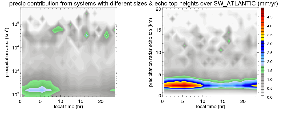
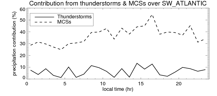
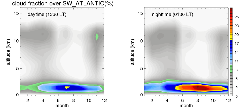
Many studies suggested that the diurnal variation of the precipitation is related to the life cycles of the precipitation systems, which is frequently driven by the surface sensible heating. Over SW_ATLANTIC, mean annual precipitation are estimated with 341.6 (mm/year) from precipitation radar. Detailed diurnal variation of the precipitation at high resolution can be accessed here (NOTE: it may take long time to generate for a large area). The diurnal variation of precipitation from systems with different sizes and heights are shown below: In total, thunderstorms (systems with detected lightning flashes) contribute 6 %, MCSs (Mesoscale convective systems with raining area > 2000 km^2) contribute 36 % of all precipitation over SW_ATLANTIC. Diurnal variations of fraction of precipitation from thunderstorms and MCSs over SW_ATLANTIC are shown below: Certainly there is a strong diurnal variation of different types of clouds. Because CloudSat observes at 0130 and 1330 local time, here the daytime and night cloud fraction in different seasons are presented: |